


NEWPORT 234 Voting District, Lake County, Illinois
About
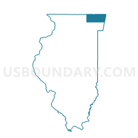
Outline

Summary
| Unique Area Identifier | 572403 |
| Name | NEWPORT 234 Voting District |
| County | Lake County |
| State | Illinois |
| Area (square miles) | 2.27 |
| Land Area (square miles) | 2.27 |
| Water Area (square miles) | 0.00 |
| % of Land Area | 99.84 |
| % of Water Area | 0.16 |
| Latitude of the Internal Point | 42.43748980 |
| Longtitude of the Internal Point | -87.89439570 |
Maps


Graphs
Select a template below for downloading or customizing gragh for NEWPORT 234 Voting District, Lake County, Illinois


Neighbors
Neighoring Voting District (by Name) Neighboring Voting District on the Map
- BENTON 47 Voting District, Lake County, IL
- BENTON 57 Voting District, Lake County, IL
- BENTON 58 Voting District, Lake County, IL
- NEWPORT 230 Voting District, Lake County, IL
- NEWPORT 232 Voting District, Lake County, IL
- NEWPORT 233 Voting District, Lake County, IL
- NEWPORT 475 Voting District, Lake County, IL
- WARREN 311 Voting District, Lake County, IL
- WAUKEGAN 355 Voting District, Lake County, IL
- ZION 445 Voting District, Lake County, IL
Top 10 Neighboring County Subdivision (by Population) Neighboring County Subdivision on the Map
- Waukegan township, Lake County, IL (90,893)
- Warren township, Lake County, IL (64,841)
- Zion township, Lake County, IL (24,413)
- Benton township, Lake County, IL (18,951)
- Newport township, Lake County, IL (6,770)
Top 10 Neighboring Place (by Population) Neighboring Place on the Map
- Waukegan city, IL (89,078)
- Zion city, IL (24,413)
- Beach Park village, IL (13,638)
- Wadsworth village, IL (3,815)
Top 10 Neighboring Elementary School District (by Population) Neighboring Elementary School District on the Map
- Beach Park Community Consolidated School District 3, IL (20,315)
- Gurnee School District 56, IL (18,189)
Top 10 Neighboring Secondary School District (by Population) Neighboring Secondary School District on the Map
- Warren Township High School District 121, IL (68,588)
- Zion-Benton Township High School District 126, IL (44,411)
Top 10 Neighboring Unified School District (by Population) Neighboring Unified School District on the Map
Top 10 Neighboring State Legislative District Lower Chamber (by Population) Neighboring State Legislative District Lower Chamber on the Map
Top 10 Neighboring State Legislative District Upper Chamber (by Population) Neighboring State Legislative District Upper Chamber on the Map
Top 10 Neighboring 111th Congressional District (by Population) Neighboring 111th Congressional District on the Map
Top 10 Neighboring Census Tract (by Population) Neighboring Census Tract on the Map
- Census Tract 8601.01, Lake County, IL (8,492)
- Census Tract 8660, Lake County, IL (6,785)
- Census Tract 8604, Lake County, IL (6,137)
- Census Tract 8615.06, Lake County, IL (5,381)
- Census Tract 8619.01, Lake County, IL (3,788)
- Census Tract 8615.07, Lake County, IL (3,115)